In 1952 the city of Seoul, Korea only existed north of the Han River and everything south of the river consisted of farmland. The only bridge crossing the Han was destroyed December 9, 1950 by the South Korean forces to keep the communists from regaining land south of Seoul, but also making travel by pontoon boat the only way for American soldiers to cross the river on the way to taking a train or truck down the single dirt road to the airbase at K16. As a member of the 440th Signal Aviation Construction Battalion B Company based at Ewha Woman’s University from September 1952 until November 1953, this is how my grandfather, Lyle Joseph Eichacker remembered Korea.
The ceasefire was signed on July 27th 1953, the exact path of the DMZ was determined and Lyle began his journey home to South Dakota in November, not to return to Korea for fifty-three years. His brother visited Korea multiple times, a son received military training there for a one month period, and Lyle planned trips to return on numerous occasions, but none of the plans followed through until his granddaughter also decided to spend one year of her life in the faraway land of Korea. Unable to let this chance slip by; in December Lyle bought two airline tickets, one for him and one for his daughter, my mother, Theresa DeLanghe. After a pit stop in Tokyo, their flight landed at Inchon International Airport at 9:15pm on Friday, March 31, 2006.
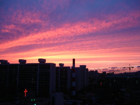
During the hour drive east to Seoul, my grandfather tried to decipher where we were from what he could remember. But although we were traveling to what today is known as Seoul, it was a whole new territory for him. The road was no longer a single lane, nor dirt and the airport was not even the same airport. K16 which used to lie south west of Seoul is now commonly known as Gimpo International Airport and has been absorbed into the Seoul city limits. Korea’s new airport was built on a man made island, has it’s own eight lane toll highway and is situated in what used to be a small port city where General MacArthur launched the attack that divided the North Korean forces in August 1950, but now is a huge metropolitan city. On that first night the only landmark I could point out that my grandfather might recognize is South Mountain. In his day this mountain was uninhabited, truly south of Seoul, and the six soldiers on his signal repair crew would use one of its natural springs to cool their beer on a hot day. Today, I know the mountain as Namsan (still meaning South Mountain), but it is situated in the center of Seoul, topped by a 77ft broadcasting tower, the top is reachable by cable car and that natural spring is most likely listed in the most romantic places to visit on Namsan. On the drive to our hotel, the Han River with upwards of fifteen bridges crossing it, and South Mountain both lay to our north. Driving down the eight lane highway that my grandfather once knew as rice paddies, my relatives gazed in awe at complex after complex of high rise apartments and bright neon signs protruding from the shorter, maybe six story, buildings declaring the many businesses contained in each. All my grandfather could say was, “how do they get all of that concrete?”
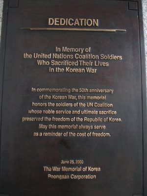
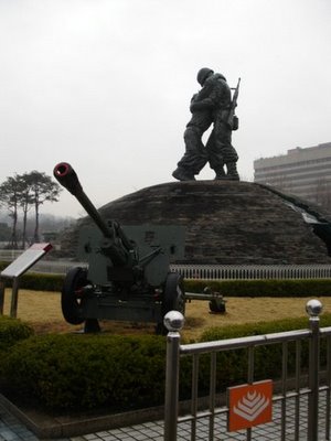
The next morning I gave them a tour of the town from a different level, underground. Out of Seoul’s ten intricately laid subway lines my grandfather and mother where able to experience travel on three on our way to The War Memorial of Korea, another on the way to lunch and a tourist information center, and a fifth before going to a Korean traditional dance, music, and theatre performance that night.
Since Korea has existed as a nation in some form for about 5,000 years and this almost sixty year period after the Korean War has been one of the longest periods in which Korea has not participated in physical warfare on it’s own soil, the war memorial, although focusing on the most recent war has many soldiers and battles throughout history to commemorate. We passed through the ancient wars exhibition quickly, due to lack of time, and then were introduced to the Korean War by a series of video clips that had recorded live action on the field and the collapse of the Han River bridge. During the next few hours I learned how and why the war began and what occurred throughout the following three years.
The Japanese internment of the Korean people was severed after World War II, and in 1948 the Soviet Union occupied the land north of the 38th parallel and the United States the South creating the Democratic People's Republic of Korea (DPRK) and the Republic of Korea (ROK), more commonly known as North Korea and South Korea. The leader of North Korea, Kim Il-Sung, knowing that the South would not convert to communism on their own, but still wanting to reunite Korea into one country launched a surprise attack on South Korea June 25, 1950. Seoul was captured by June 28th and almost the entire peninsula occupied by communists by September. The United States 8th Army and UN forces from twenty-two countries assisted the ROK soldiers in pushing the DPRK army all the way north of Pyongyang (the capital of North Korea) and past. Then China joined the North Korean forces with a volunteer army, Seoul was recaptured by the DPRK, then back in the hands of the South, and negotiations for a ceasefire and re-declaration of the Armistice line began. That is when Lyle came to Korea. Seoul was stabilizing and the war was mainly discussions and a few battles near the 38th parallel and his job was to make sure the phone lines were erected and repaired to keep communications stable between bases.
At the War Memorial and a few other locations throughout his return visit, my grandpa discovered relics from his past. Several items in the Korean War exhibition caught his eye including examples of rations and uniforms, but the most notable is the name of a soldier from his hometown engraved on the wall of those who did not go home. Also outside on the grounds of the memorial, he found a “flying boxcar”, the kind of plane he had flown in on from Japan to K16 after the eleven day voyage to Japan from California by boat. He exclaimed, “I never thought I’d see one of these again,” and commented on how impossible it is for a six foot man to sleep in the mesh seats they called sleepers.
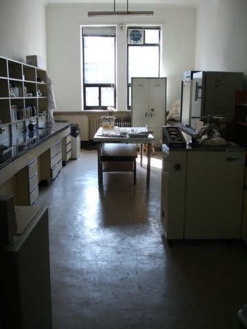
After a quick two day visit to the Southeastern corner of Korea with a short ancient history lesson in Kyung-ju, we sped back up to Seoul at about 200mph on the KTX train, paid a visit to my Korean high school, and returned to memory lane; next stop Ewha University. When I tell Koreans that my grandfather lived at Ewha, they always tell me that it’s impossible, because men can not live at a woman’s college. Even administrators from the university didn’t know that the campus had been used as a military base during the war, but Lyle arrived with his photo album in hand and during a tour could even point out the room he had lived in. No one on campus knew anything about a bell that used to stand between two of the oldest buildings. The main hall, which was unusable after being air bombed in combat before he was first there has been restored, and the room he had used as a dorm is currently being used as a science lab where bacteria is cultivated. We were unable to visit the school’s history museum and it does not reopen until May 25, but when it does my grandfather’s pictures may be included as part of the display.
The day at Ewha brought forth memories of playing billiards in the fourth floor rec room, hauling extra soldiers out to the town for some extra cash whenever his crew left base to fix a telephone line and, the bell that was rung to announce dinner which stood next to his dorm, but now a statue stands in its place. As we left his dorm building Lyle commented, “the door still squeaks,” which showed that although the campus has thoroughly changed, a few things remain the same.
Due to the fact that my grandfather had been part of the military during the war and in Korea when the ceasefire was signed, parts of the trip became highly military oriented. In ten days we visited the War memorial of Korea, the UN cemetery in Busan, the National Intelligence Security (NIS or Korea’s CIA) visitor’s building, Panmunjom and the DMZ, the United States army base in Yongsan, and Korea’s equivalent to America’s West Point military academy. Each had its own interesting attributes, such as the NIS’ information on North Korean infiltration and spies throughout the past fifty years and examples of secret spy weapons, like a pen that held poisonous darts. When we were at the UN cemetery, my grandfather asked me to take some photos of the pictures capturing the life of marines, because he has a good buddy who served as a marine during the war. Then at the military academy’s museum he found in the gun display an M1 rifle and a Carbine rifle, which were the guns he had carried. We also found a small switch board, a commemorative silver medal for participation in the Korean War just like the one he received a couple years ago from the Korean government, and outside on the grounds stood an M46 tank, the same kind another of his friends had helped man during the war.
The most intriguing location due to its historical significance and current military tension was Panmunjom in the DMZ. With the help of an army friend, Torie and I booked four spots on a tour offered through the USO before my parents even came to Korea. The four of us stayed at a hotel Thursday, April 6th, the night before the tour so we could arrive at the USO office by 7am for its commencement. It must have been relaxing and very ordinary for my parents to be traveling on a tour bus with only Americans, all of whom could speak fluent English and some of whom had blond hair, but for Torie and I it was a bit of reverse culture shock. In good traffic conditions, the line of Demarcation is only a little over an hour from the center of Seoul. Approaching the line, our bus passed through a series of military check points where our passports were checked and photos prohibited. At the last checkpoint, Camp Bonifas, which is the base camp for United Nations Security Force –Joint Security Area, we were briefed on what we should and should not do while inside the Demilitarized Zone and asked to sign a document saying that if anything happened to us while inside DMZ that the United Nations was not at fault.
From Camp Bonifas the tour group transferred to military tour buses and entered the Demilitarized Zone and then Joint Security Area (JSA) commonly known as Panmunjom. The village of Panmunjom was destroyed during the war, but since it was a neutral location on the 38th parallel, a tent village was constructed for the Armistice peace talks to begin and eventually, the Truce was signed. . In time, buildings replaced the tents and Panmunjom became the Joint Security Area for the two nations, where everyday ROK and DPRK soldiers stand face to face on guard for their countries. The North and South’s main headquarters face each other, separated only by open air, a row of blue buildings divided hamburger-wise through the center by the Military Demarcation Line, and foot soldiers. The Military Demarcation Line (MDL), which is the exact line near the center of the DMZ that divides North and South Korea, is only visibly marked in the JSA outside the buildings by a six inch high concrete barrier and inside the buildings, by a seam in the carpet. While our tour stood in between the two headquarters North Korean soldiers were visible at their main posts and sometimes traveling from one building to another. The Army tour guides revealed that there were other soldiers watching us from cracks in the doorway, or posts in the trees, and that we were always being video-taped. Caution was enforced to not make gestures including smiles toward the North Korean soldiers, not to stop as our line was moving, and not to go anywhere near the MDL outside of the Military Armistice Commission Building (T2) unless you wanted to become a “personal guest” of North Korea.
T2 is the building where any sort of negotiations between North and South Korea or North Korea and organizations such as the Red Cross or Olympic committee are able to take place. During the negotiations translators sit at the ends of the tables straddling the MDL, while officials from the respective countries take seats on opposing sides of the negotiations table. Although maybe six building straddle the MDL, tourists’ entry is only permitted to T2 where we could not only view the negotiation tables and take pictures with the rigid ROK soldier guards, but also step over the seam in the carpet into what is technically communist North Korea.
After crossing into North Korea and safely back while inside the protection of the Military Armistice Commission Building’s walls, the tour continued in the bus past, “the Loneliest Place in the World”, the Bridge of No Return and the scene of the 1976 Ax Murder Incident at Panmunjom. The loneliest place in the world had become a nickname for UNC checkpoint 3 during the time when North and South Korean soldiers were endowed free roam on both sides of the MDL in the JSA. The UNC checkpoint 3 located nearest to the North Korean’s point of entry to the South and obstructed from line of sight from the next nearest outpost by an enormous poplar, was the loneliest and scariest place for an American or South Korean soldier to be stationed. August 18, 1976 the United Nations command decided to do a routine trimming of the tree to provide better visibility, but the KPA (North Korean Soldiers) did not agree with the decision even though the tree was on the South side of the MDL and told the American soldiers to stop. The soldiers sent to due the cutting held to their task as the KPA forces gathered around them, but after Captain Bonifas, the leader of the Americans in the task refused a second time, the KPA were commanded to “Kill the Americans!” and within four minutes the two captains were murdered and a total of ten more soldiers both American and ROK injured by the axes they had been peacefully using to prune a tree.
The tree was finally removed under full military forces including helicopters and fighter planes later that year, UNC checkpoint 3 was no longer necessary with the increased visibility and the MDL could no longer be crossed at will. The Bridge of No Return, directly adjacent to UNC checkpoint 3 gained its name from the prisoners of war who had to choose either the North or the South and after crossing this bridge were never allowed to return to the other side. The crew of the USS Pueblo, taken captive by North Korea on Jan 23, 1968 in international waters outside the coast of Korea and held captive for eleven months, was also released across the Bridge of No Return. “The release was made only after the Senior US Representative to the Military Armistice Commission, Major General Gilbert H. Woodward, signed a document stating that the USS Pueblo had illegally intruded into the territorial waters of North Korea.” (Panmunjom by Wayne A. Kirkbride) and the document was only signed so as to not start another war.
Part of the Armistice agreement included that each of the two countries would keep one village within the Demilitarized Zone. The South has Taesong-dong also known as Freedom Village, where a group of families decided to remain on their ancestral land. In Freedom Village men are exempt from military service and the US government pays each family $80,000 a year for the rice crop they produce through farming, but everyone has to be back in the village by dark and have doors and windows locked and lights out by 11 o’clock at night. The North also has a village that civil workers maintain to look like a wonderful place to live, but no one actually does live there. Up until very recently the whole village was rigged with a powerful sound system that would broadcast propaganda sometimes twenty-four hours a day promoting North Korea to South Korean soldiers and proclaiming that living in North Korea was like living in paradise. The two villages are most visible by the enormous flags flying one hundred meters high in Taesong-dong and even higher and larger in Propaganda village.
The tour continued to the 3rd Infiltration tunnel after leaving Panmunjom. The historical significance is interesting, but truthfully it just felt like a hole in the ground with a long incline leading down to it. My mom and grandpa made it to the mouth of the tunnel before turning around just to climb right back up the long path. Torie and I followed the tour guide towards the front of the group with our hard hats on and me bending my neck to walk safely through. The whole group held an anticipation of “what might be at the end?” but all we found was a big boulder blocking the path to go further and then turned around to go back. When we met my grandpa at the top he said, “Those North Koreans can sure dig holes through mountains, but the South Koreans have mastered digging them through cities.”
After the DMZ tour on Friday, the trip began to wind down a little with souvenir shopping with my third host mom in the crazy bargain market of Namdaemun and the tourist street of Insadong on Saturday. Then we ate Saturday dinner with my first host family to celebrate my mom’s birthday, April 8th. Sunday I had planned to just go to mass at a Catholic church near my regular church and then spend the rest of the day packing and resting. But, after a Palm Sunday Mass with evergreen branches, we visited the military academy and then shopped for an extra suitcase for grandpa to bring home all the jewelry boxes he had bought for his wife and daughters in law.
Sunday evening was my first chance to spend only with my mom and Torie, leaving grandpa at home to rest. We returned home for dinner, then mom and grandpa packed, slept and were up early the next morning to return home. On the airport limousine (bus) ride back to the airport we passed South Mountain, the Han River bridges, eight lane city roads and hundreds of twenty-plus story apartment buildings.
My grandpa had first arrived in a war torn, poverty stricken county where everyone was trying to get back what they had lost during the war and make ends meat. Transportation consisted of army trucks, a pontoon for a bridge, and a train to the army base. In 1952, Seoul was generally a small city, but on April, 10th, 2006 he left a first world county with intricate subway systems and trains that travel 200mph. He left a city with a population of ten million people and an apartment seventy stories tall, but he left with memories of both eras and an understanding of how and why the city he knew had changed into the new world.


 The war memorial.
 My original plan was to take it easy. My mom and grandpa had just flyed something like 16 hrs to come to the other side of the world, so I purposely booked a hotel right next to the nicest park in Seoul, Olympic Park. I thought we could wake up a little later and then go for a walk in the park and maybe to a traditional Korean dance performance that night. But God doesn't always agree with the plans I choose, so he decided to have it rain all day.


